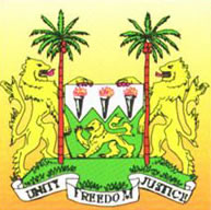

Coat-of-Arms

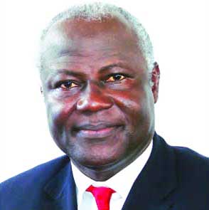
President Ernest Bai Koroma
 |
 Coat-of-Arms |
 President Ernest Bai Koroma |
Sierra Leone is located on the west coast of Africa north of Liberia and south of Guinea. Mountains rise up to 3,000ft above sea level near the capital, Freetown.
Consistently hot and humid, the country has a six month rainy season and an average annual temperature of 27C (80F). Except for tiny European, Creole, Asian and Lebanese minorities, most of Sierra Leone’s approximately 5.2 million residents belong to one of 18 native African tribal groups. The two largest are the northern Temne and the southern Mende. Animism is the primary religion, but Christianity and Islam are also represented. The official language is English, although Temne, Mende and Krio (Creole) are widely used. Sierra Leone is in the GMT time zone.
From it’s beginnings as a haven created by British philanthropists for freed slaves, Sierra Leone went on to become a British crown colony and a protectorate before gaining independence in 1961. Since independence Sierra Leone has alternated between multiparty democracy and single-party rule, and between civilian and military governments. due to a history of widespread corruption, the monopolisation of power and wealth by a small elite, a decade of civil war and Liberian intervention the country is regarded by the UN as the poorest in the world. Although rich in diamonds, Sierra Leone's development has been blighted by acute political instability, which plagued it soon after independence in 1961.
The road network is the principal artery of communication but the lack of paved roads and investment mean that many areas of the country are difficult to reach during the rainy season. The regional administrative and population centres are all linked to Freetown by highways. The government hopes to upgrade many roads but has been hampered by lack of finance. Inland waterways not only supplement the roads but are the main link for some areas, most waterways are navigable all year. The port at Freetown and international airport at Lungi are the principal international connections. There are a number of smaller regional airfields.
Although the majority of the labour force is occupied in subsistence agricultural and light manufacturing, the country’s main source of foreign exchange is mining, principally diamond mining. Other minerals found are bauxite, chrome, gold, iron ore and rutile (a titanium ore of which Sierra Leone has one of the world’s largest deposits). Bauxite and legitimate diamond production were largely halted during the civil war, while rutile production was suspended. Despite intensive efforts Sierra Leone has not achieved self-sufficiency in rice production. Cash crops include cocoa, coffee and palm kernels. Timber is also exported, although a significant proportion of logging is illegal. The fishing industry is growing specifically with regard to oyster farming and shrimp production. Stocks have been seriously affected by the inability to stop over-fishing and illegal fishing by foreign vessels. Sierra Leone is attractive as a tourist destination due to the beaches on the south side, national parks and nature reserves, however poor infrastructure and facilities make these destinations inaccessible.
Poor infrastructure and social unrest slowed economic development. The road network needs improvement and, while the port at Freetown is one of the best natural harbours in the region, it is small and does not fulfil its potential. There is a large wealth differential, causing over two thirds of the population to be poverty-stricken.
Political instability, corruption and poor governance has led to a lack of foreign investment that forces the country to rely on foreign financial aid.
[ Home | States | Countries | Societies | Library | Blog | Search ]
Contact: info@webafriqa.net
© 1997-2010 Tierno Siradiou Bah & Afriq Access. All rights reserved.